- Station Name:
- Hannahbear Creek
- Latitude:
- N 69.980°
- Longitude:
- W 153.066°
- Elevation:
- 37.5 masl
- Drainage Area:
- 22.7 km2
- Record:
- 2012 – present
- Purpose:
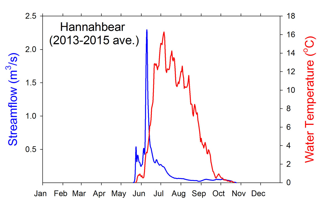
This station was established to provide hydrologic data for the upper Fish Creek Watershed representing the Pleistocene Sand Sea region, which makes up a large portion of this watershed and the Arctic Coastal Plain of northern Alaska. The gauge location is near Ingiok, a BLM field camp, and flows into the South Fork Fish Creek. Fish surveys in this watershed show abundant populations of Broad Whitefish and Arctic Grayling among other species.
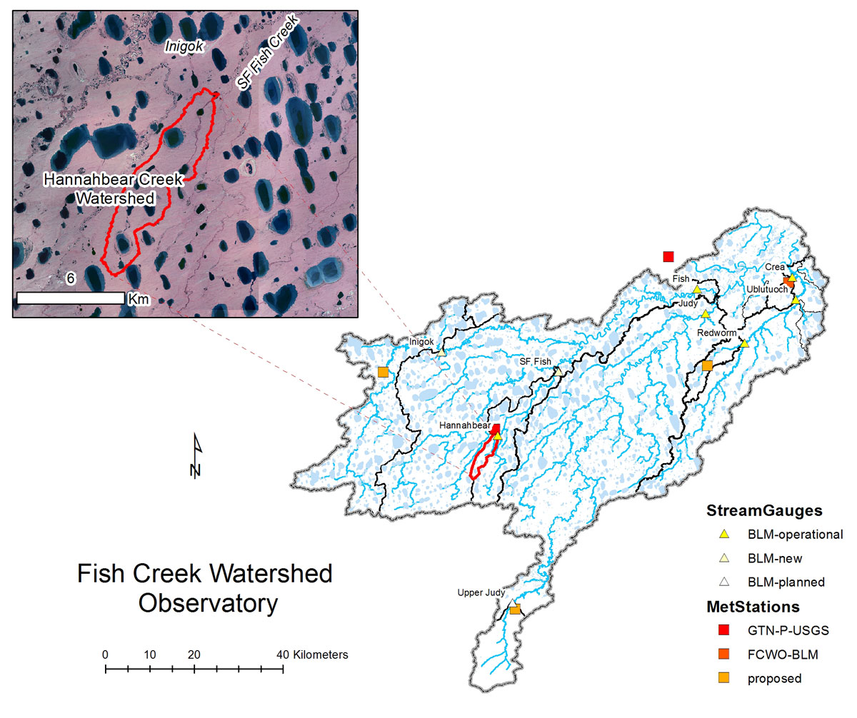
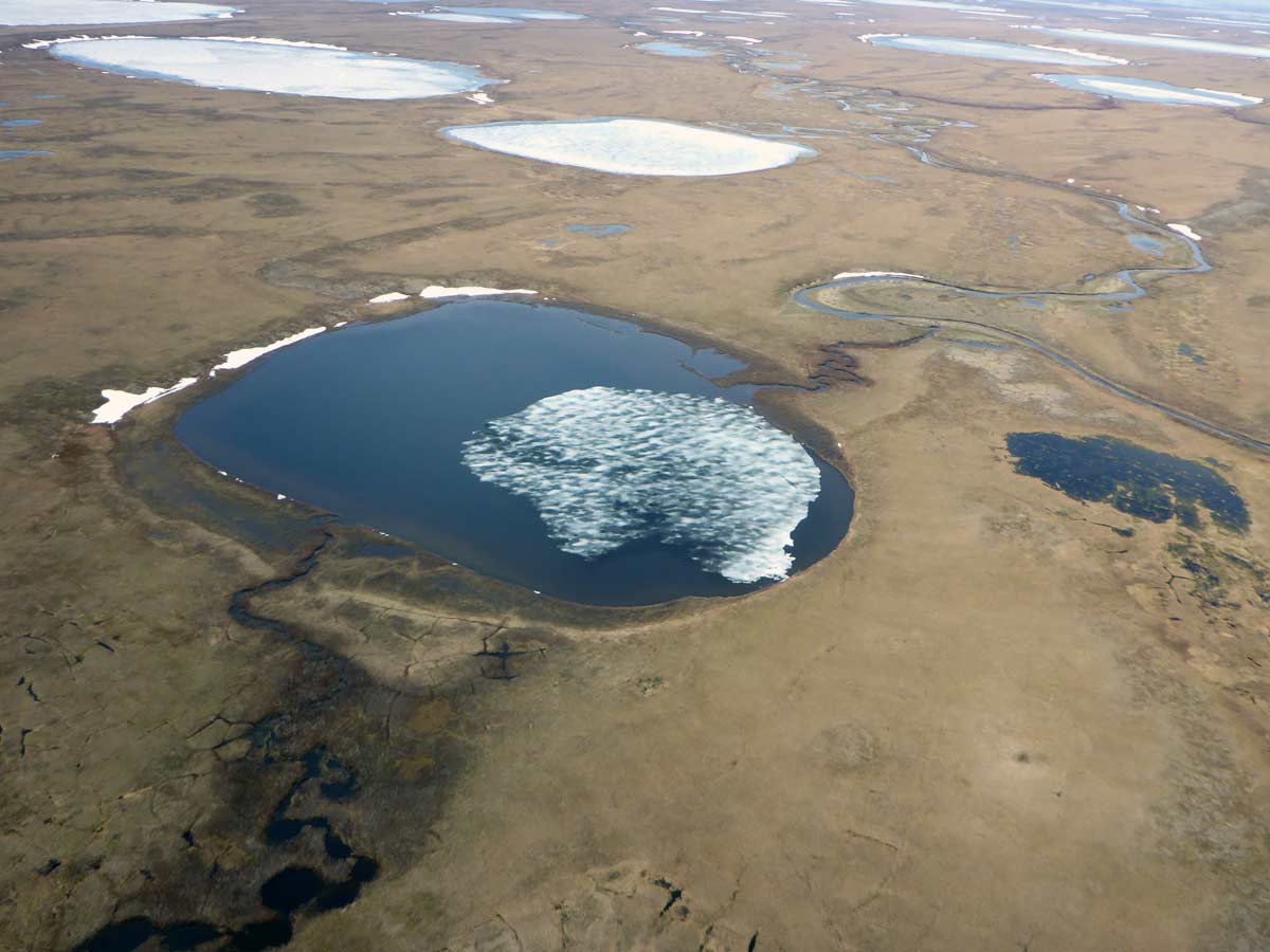
Hannahbear Creek flowing through Hannahbear Lake and into SF Fish Creek near Inigok.