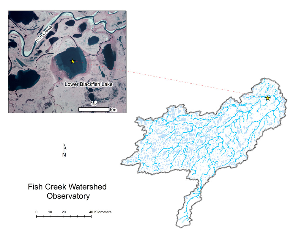
- Station Name:
- Lower Blackfish Lake (MC7916)
- Latitude:
- N 70.299°
- Longitude:
- W 151.463°
- Elevation:
- 0.5 masl
- Lake Area:
- 166 ha
- Mean Depth:
- 2.1 m
- Record:
- 2011-2013 (discontinued)
- Purpose:
Originally studied for location downstream of GMT1 and its importance as habitat for numerous fish species including whitefish, northern pike, burbot, and arctic grayling, this lake is strongly connected to Fish Creek and likely experiences backwater flooding regularly. Large water level changes made maintain lake monitoring stations here quite challenging. This lake has also served as a winter landing strip in some years.