- Station Name:
- Oil Creek
- Latitude:
- N 70.302°
- Longitude:
- W 151.281°
- Elevation:
- 3.3 masl
- Drainage Area:
- 24.3 km2
- Record:
- 2009 – present (missing data in 2010-11)
- Purpose:
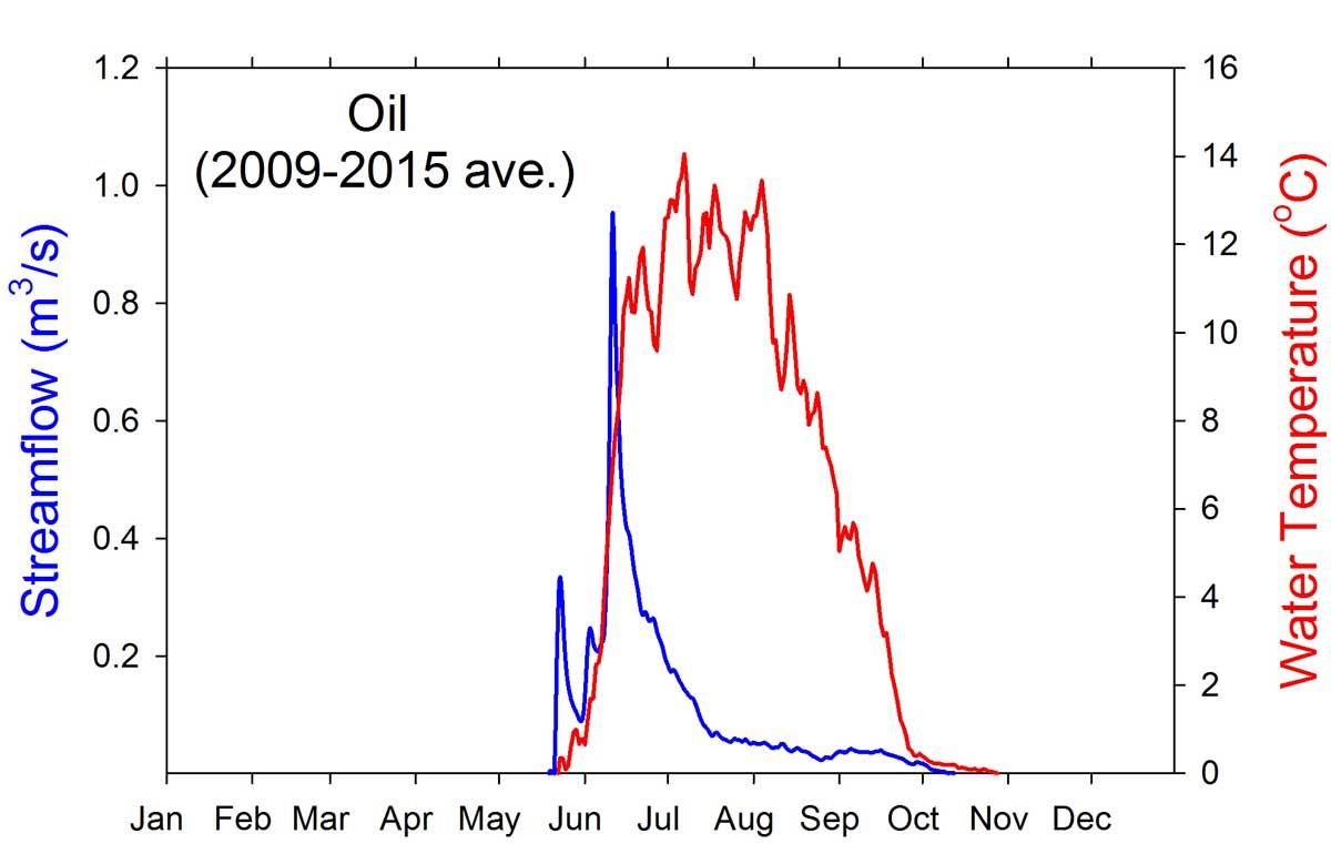
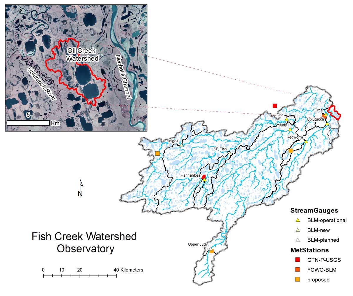
This station was established to collect baseline data prior to development and during operation of ConocoPhillips Alaska Inc.’s new CD-5 project, which was completed in 2015. Within the watershed this includes a permanent road and drilling pad. This is the first oil development within the National Petroleum Reserve – Alaska (NPR-A). This beaded stream system is fed by to large lakes called the Oil Lakes and discharges into the Ublutuoch River.
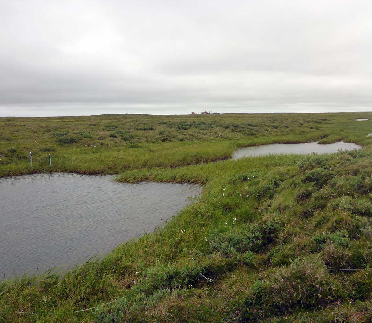
Monitoring station at Oil Creek looking upstream towards newly completed oil drilling pad CD5.